 | Early source material on the Danish Virgin Islands.
Christian Georg Andreas Oldendorp.
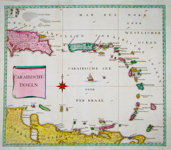
Leipzig, 1777. The illustrations from the important account of the Moravian missions on the islands of St Croix, St Thomas and St John, then Danish possessions but now part of the British and U.S. Virgin Islands. The maps are all by Paul Küffner: a general map of the Antilles; St Thomas; & St Croix. The plates are all after Oldendorp: two views of Frederiksted on St Croix, St Thomas and St John.
OLDE0001 | £2800.00
More details
|


